
Definitions of Waterways
There are 4 classes of water in Victoria: Inland, Enclosed, Coastal and Offshore Coastal
Inland Waters are rivers (inside of the seaward entrance), creeks, canals, lakes, reservoirs or similar waters - natural or constructed, public or privately owned, but excluding navigable rivers/creeks/streams within declared port waters.
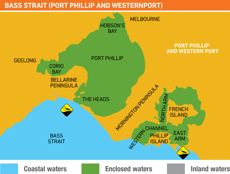
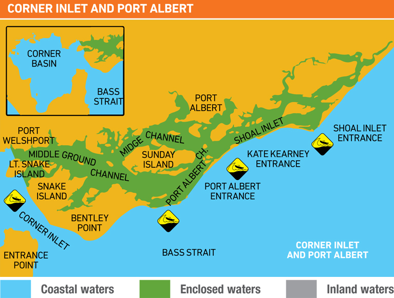
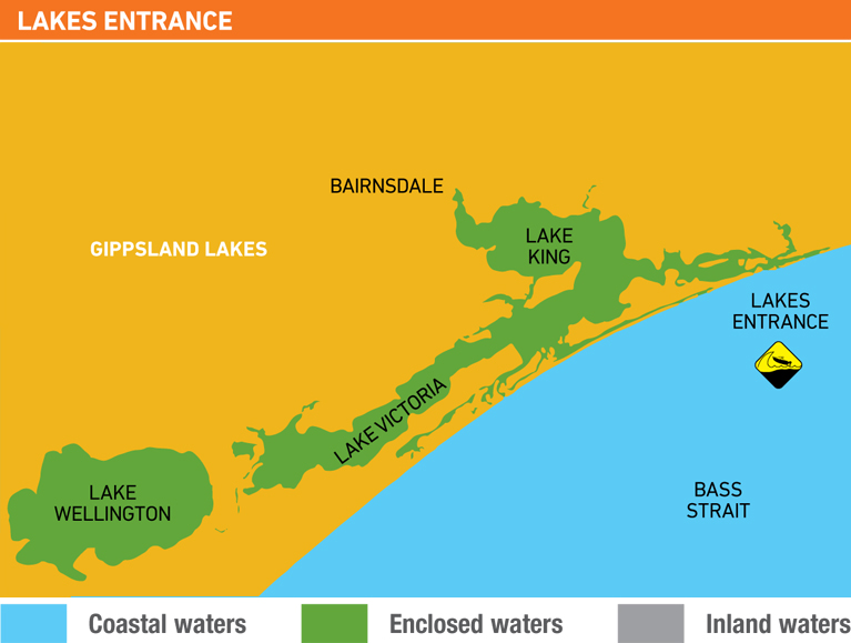
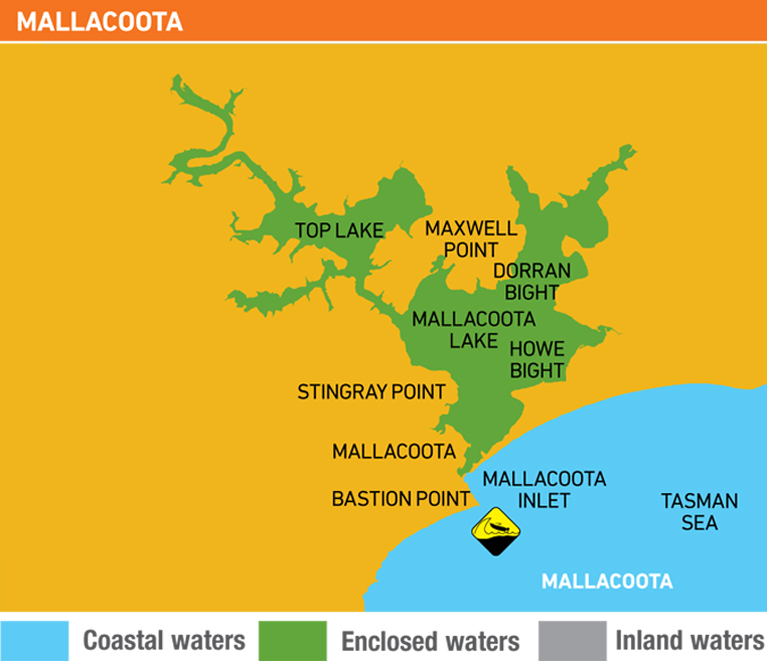
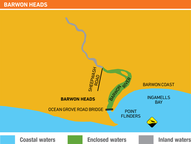
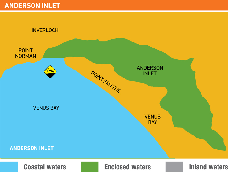
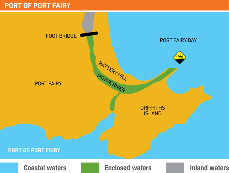
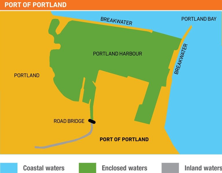
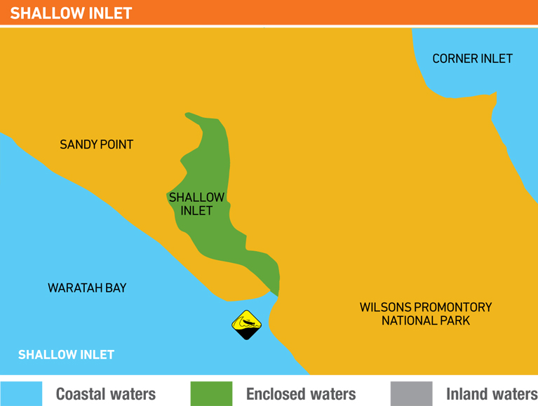
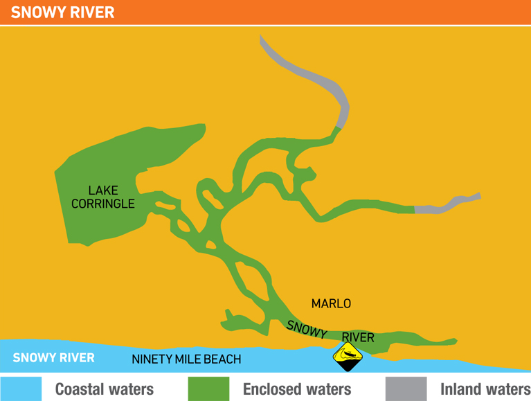
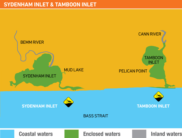
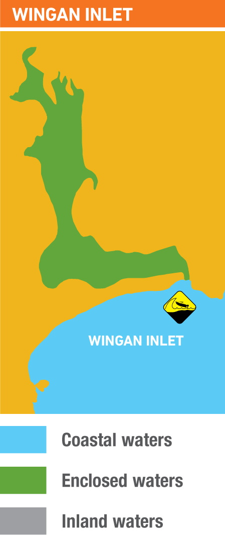
Enclosed Waters are declared port waters, including Port Phillip Bay, Westernport, Gippsland Lakes, port areas around Port Welshpool and Port Albert (including Nooramunga Marine National Park) port areas of Barwon River, Apollo Bay, Anderson Inlet, Snowy River, Port Fairy, Portland, and inlets such as Shallow Inlet, Mallacoota Lakes, Tamboon Inlet, Wingan Inlet Sydenham Inlet - see the maps below or consult the Maritime Safety Victoria website for a full list
Coastal Waters are all waters other than inland waters or enclosed waters. Coastal Offshore is greater than 2 nautical miles offshore and additional safety gear is required by law. In Victoria we think of Bass Strait when we think of coastal waters, but note it also includes Corner Inlet - see the maps below.
Enclosed Waters can be as exciting as Coastal OffShore, we recommend that you carried the suggested coastal offshore equipment when in all waterways. Its better to be safe then sorry!
Source: Maritime Safety Victoria. For other states you should consult your local Maritime Authority:
Marine and Safety Tasmania (MAST) - smooth, sheltered and coastal waters
Roads and Maritime Services NSW - enclosed and open waters
Maritime Safety Queensland - smooth, partially smooth and open waters
Department of Transport WA - protected and unprotected waters