
Phillip Island is a fantastic venue for coastal and offshore sea kayaking with Cape woolamai offering one of the most spectacular paddles in Victoria. Just under 2 hours away from Melbourne it's a perfect day trip or alternatively book some accommodation on the Island and make a weekend of it. That being said it is important to remember that sea kayaking is subject to the wind and tide, it is just as important to know when NOT to go as it is to know when to go. We suggest you undertake kayak training before taking on this paddle, alternatively, you can join us on a guided tour. This true sea kayaking.
Highlights
Cape Woolamai
Spectacular scenery
Blue water
Paddling in bass strait
Old Granite Quarry
Sea Caves
Planning
When planning for this paddle it is important to assess the conditions as this location can be exposed to enormous fetch from the South East, South, South West and swell coming straight off Bass strait. It is important to be patient and choose the right conditions, when you do this it is such a magical paddle. It's even worth have a quick look out at Woolamai Surf Beach via Anzacs Beach Parking to check out the ocean conditions before heading down in to Cleeland bight.
Tides
Getting the tide right is the key for the Cape Woolamai paddle and there are a few factors to consider. This is a technical paddle, you are dealing with constriction, sweeping tide and, protruding landmass’s.

Constriction
Constriction is when the tide becomes “constricted” when the environment becomes narrow or shallow causing the tidal stream to increase in speed. At Cape Woolamai the constriction occurs between San Remo and the Eastern coast of Phillip Island (see chart).

Sweep
A sweep refers to the current that flows on the outside of a bend in a river, ocean constriction or protruding landmass. The fastest moving water “sweeps” around the bend while the water on the inside of the bend moves at a slower rate.

Protruding landmass/Eddies
When a headland or promontory juts out into a tidal current, current speed will increase generally towards the most exposed part of the land. Creating a low pressure system or “eddy” behind the protruding landmass (see map)
When paddling Cape Woolamai ideally it will be low tide at 12pm, this allows you to take the tide out around Cape Woolamai and ride it back after lunch. Below is a list of the resources we use when planning a paddle. Remember tides are the rise and fall of sea levels caused by the combined effects of gravitational forces exerted by the Moon, Sun, and rotation of the Earth. Therefore you can find tidal predictions for years in advance.
For San Remo tides check: http://www.bom.gov.au/australia/tides/#!/vic-san-remo

Alternatively you can print out the relevant tidal charts PDF here: http://www.bom.gov.au/ntc/IDO59001/IDO59001_2022_VIC_TP029.pdf
Winds
Unlike the tide winds can’t be forecast years in advance. Therefore interpreting the winds for your paddle begins 4 days before you plan to put in and require you to have an understanding of Fetch and Lee. There are some fantastic tools you can use to monitor the forecast wind and make good judgement calls. Here are the resources we use to monitor wind conditions and forecasts for this particular location.

Remember this location can be exposed to enormous fetch from the South East, South, South West and swell coming straight off Bass strait.
MetEye
MetEye, forecast map for Port Phillip bay and Western Port: http://www.bom.gov.au/australia/meteye/?loc=VIC_MW005
Victorian Forecast Areas Map
http://www.bom.gov.au/vic/forecasts/map.shtml
Western Port Local Waters Forecast
http://www.bom.gov.au/vic/forecasts/westernport.shtml
Central Victoria Coastal Waters Forecast: Cape Otway to Wilsons Promontory
http://www.bom.gov.au/vic/forecasts/centralcoast.shtml
The Paddle
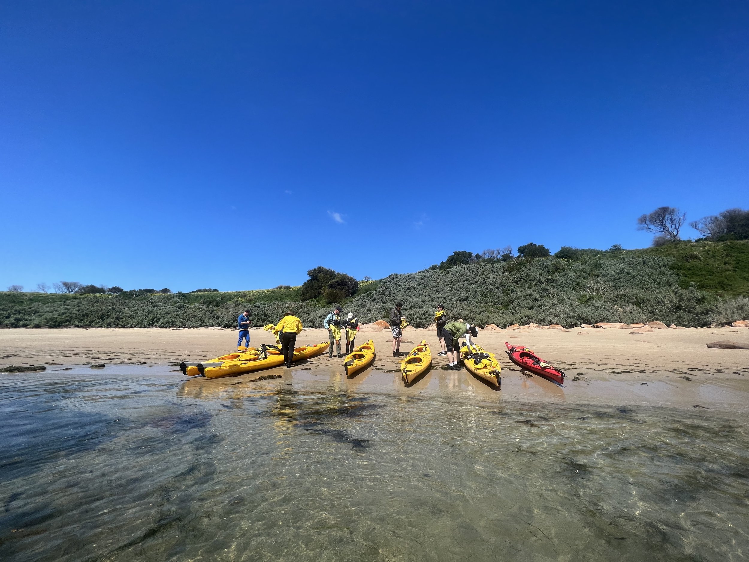
The Cape woolamai Paddle begins at the Cleeland Bight accessed via Cottosloe Ave. Cleeland Bight offers plenty of free parking, toilets, change rooms and outdoor showers.

The first leg of the journey takes you past enormous sand dunes towards the old Granite quarry which is a great spot for lunch upon return, it is 2.5km from Cleeland Bight.
If you are unsure of the conditions around this point then the Old Granite quarry offers the ability to stop and take a short walk to peak around the point to assess the conditions.
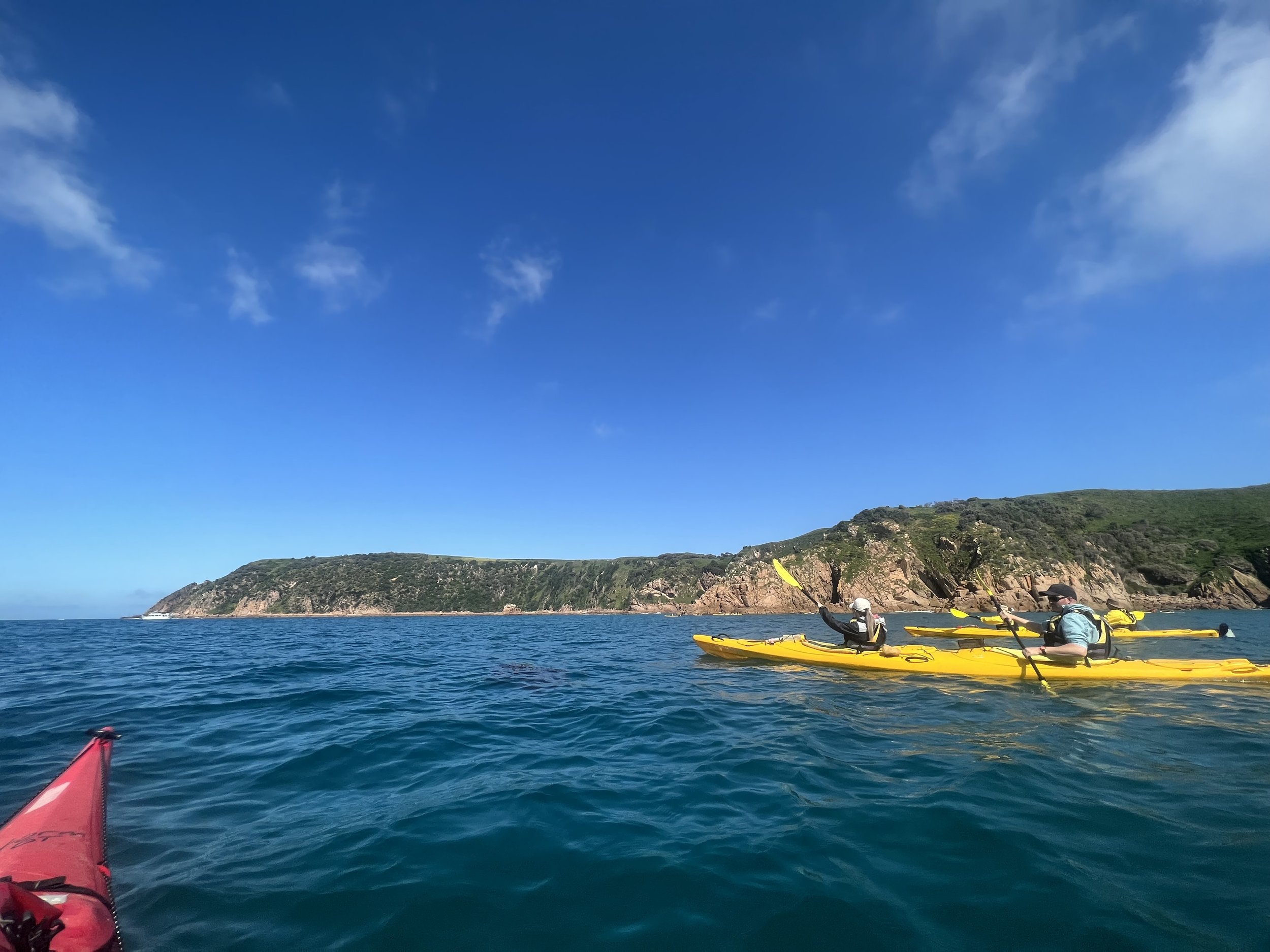
Once you leave Old granite quarry there are no places to land (we call this the point of no return) until you return on your way back. The second leg takes you out into Bass strait and alongside the magnificent Cape Woolamai. Enjoy stunning views down the Gippsland coast towards Kilcunda, spot seals fishing off the rocks and keep an eye on the skies as sea eagles can be spotted soaring high above. On the perfect day (flat as a tac) you may have the opportunity to reverse into the sea cave for a fantastic photo (only attempt this in perfect conditions). It is 2km from the Old Granite quarry to Gull Island (See map) and an extra 1km to the tip of Cape Woolamai which should only be accessed in ideal conditions. Gull Island offers a great turn around location and photo opportunity.
Once back at the Old Granite quarry it is time for lunch and some relaxation. Enjoy a walk along the beautiful beach or around the point, go for a swim or explore the old quarry.
Once your group is well rested it is a short 2.5km paddle back to Cleeland Bight with tide assistance.
The Cape Woolamai paddle is one of Victoria's best sea kayaking experiences, undertake kayak training before you paddle or join us on one of our upcoming tours.